Last weekend was a restful one in Fairbanks, spent relaxing, catching up (laundry, paying bills, email, etc.), and resting. We find we enjoy our travels more if we take a break occasionally from sightseeing and being tourists. One of the highlights of the weekend was an early dinner Sunday night at a local Italian restaurant, Gambardella's. We were hungry for pizza, so we asked a local where to get good pizza, and she recommended them, saying it was an authentic Italian restaurant and much better than the Pizza Hut we were considering. It was in an older building, but flowers were planted outside, and the inside had been redone nicely--a little fancier than we expected, with cloth tablecloths and napkins :). Our waiter took us to an upstairs section, where there was also an outdoor deck/balcony, but we opted to stay inside since it was cool and cloudy outside. The pizza was superb . . . some of the best we'd ever eaten, as was the Chianti. The pizzas were much larger than we expected--they were supposedly individual sizes, but they turned out to be about the size of most medium pizzas (so we took some back to the camper and ate it the next night). After seeing some cheesecake go by on the way to another table, we couldn't resist, so we splurged on that, too--and it too was delicious! As we were finishing, our very attentive Bulgarian waiter came to our table with his accordion and serenaded us with accordion music! A very memorable evening!
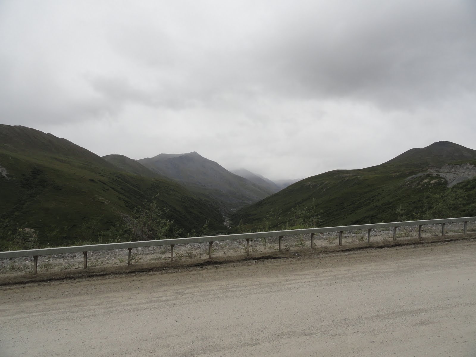
Monday morning we headed out of Fairbanks toward Denali. We stopped outside Fairbanks overlooking the valley, and could see smoke from the wildfires that had been burning the previous week. At several points during the week, we had noticed the distinct smell of forest fires and could see smoke from them on the way to the Arctic Circle. Below is a picture showing the smoke still smoldering. Apparently that's a common occurrence during summer months in Alaska.

View of the Nenana River valley south of Fairbanks

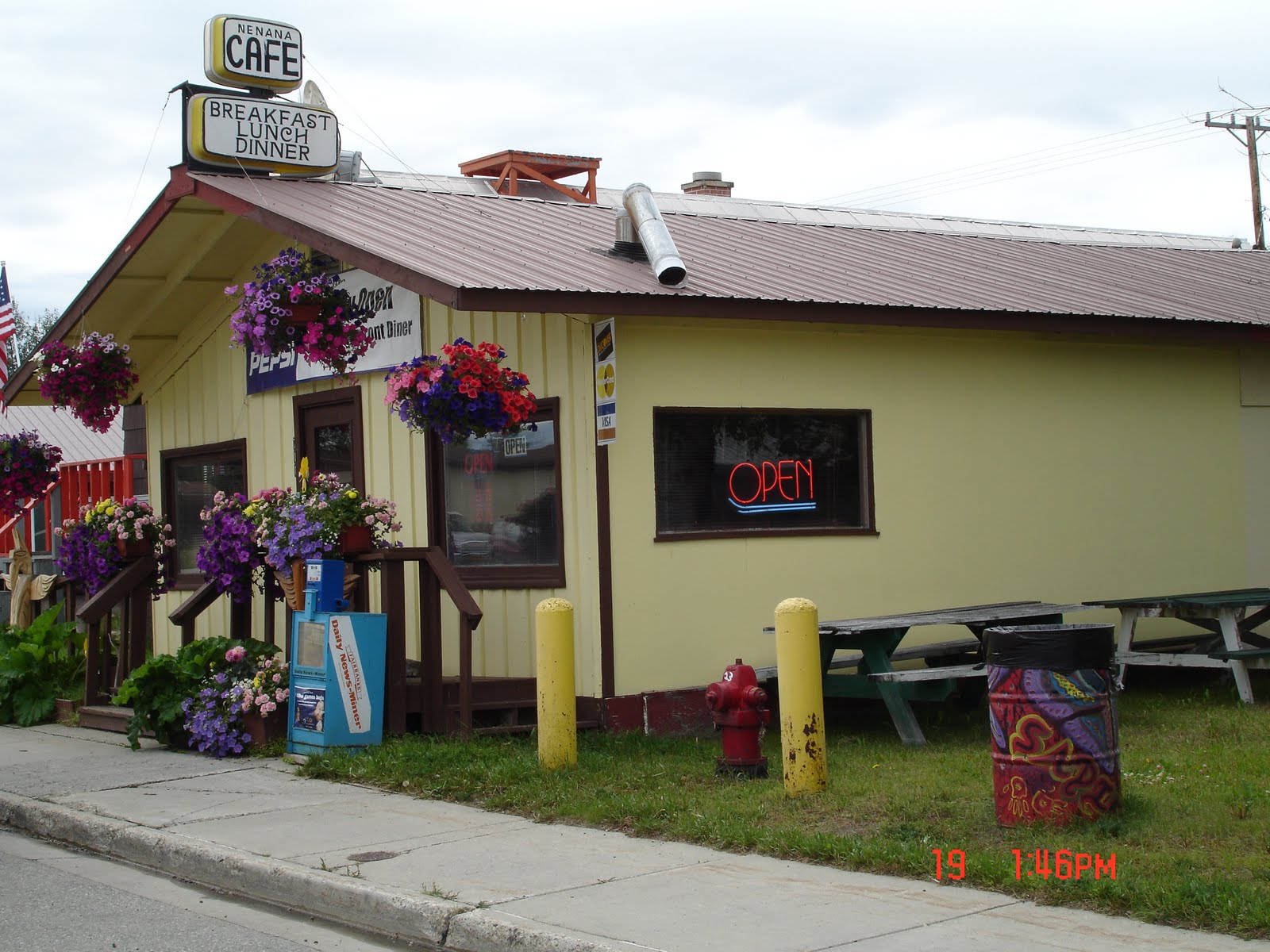
We ate lunch in the little town of Nenana at this local cafe. Turns out the owner is an ex-Navy guy, so he and Ernie had lots to chat about. This is definitely an Ernie kind of cafe! I loved the flowers--flowers in Alaska are beautiful, even though the growing season is so short . . . I assume because it doesn't get so hot and wilt them as in Indiana!
We arrived in Denali Monday afternoon, got a space in a campground and drove to the park to preview it before spending more time there Tuesday.

Private vehicles are allowed to drive into the park only 15 miles; only one road goes into the park, and it's restricted to Park vehicles and a few others with special permits. They've done this to minimize the impact of tourists on the wilderness area and wildlife, in order to allow the land and animals to remain wild. So the only way to see the park after the 15 miles is to go on one of their buses or hike (with a permit). We investigated the different options for bus rides, chose one that goes into the park 66 miles and lasts 6 to 8 hours (the longest goes 92 miles and lasts 11 to 12 hours), and made our reservations for the next day. Then we drove the 15 miles as far as we could on our own.
One of our first views of Denali National Park and Preserve

From the Savage Creek Turnaround, which is as far as individuals are allowed to drive on their own

Denali Park Road and mountains from Savage Creek Turnaround

Savage Creek and bridge over Denali Park Road

Savage Creek

Rock formations at Savage Creek Turnaround--there was a path up the rock in the foreground, which we climbed. Ernie went a little farther than I did.

Views from the road

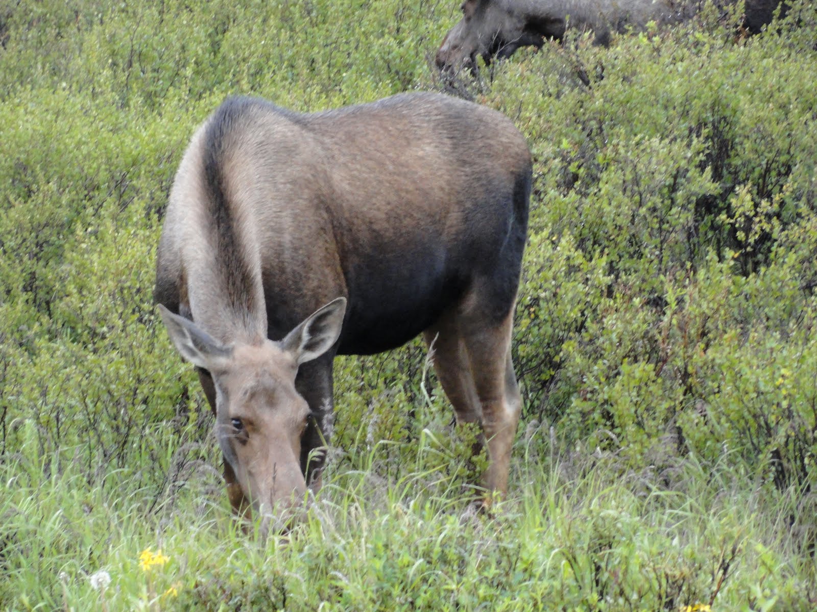
 The next morning we boarded a bus for our ride to the Eielson Center and back, a trip of 66 miles each way. One of the goals of the trip, of course, is to spot wildlife in their natural habitat. Wildlife is not controlled at all and allowed to live freely in the wild, unrestricted by humans; no fences or borders hamper their movements. We were told that our behavior should not in any way cause changes in the animals' natural behavior. Whenever anyone spotted an animal, they would give the location, and the driver would stop the bus to give everyone time to observe and photograph (from the bus). Most of the animals were very far away, so it was difficult to see them sometimes (especially with my diminished eyesight--which was rather frustrating). Our driver was very knowledgeable and gave us lots of information about the park and the animals.
Some of the first animals we spotted were some moose grazing on willows.
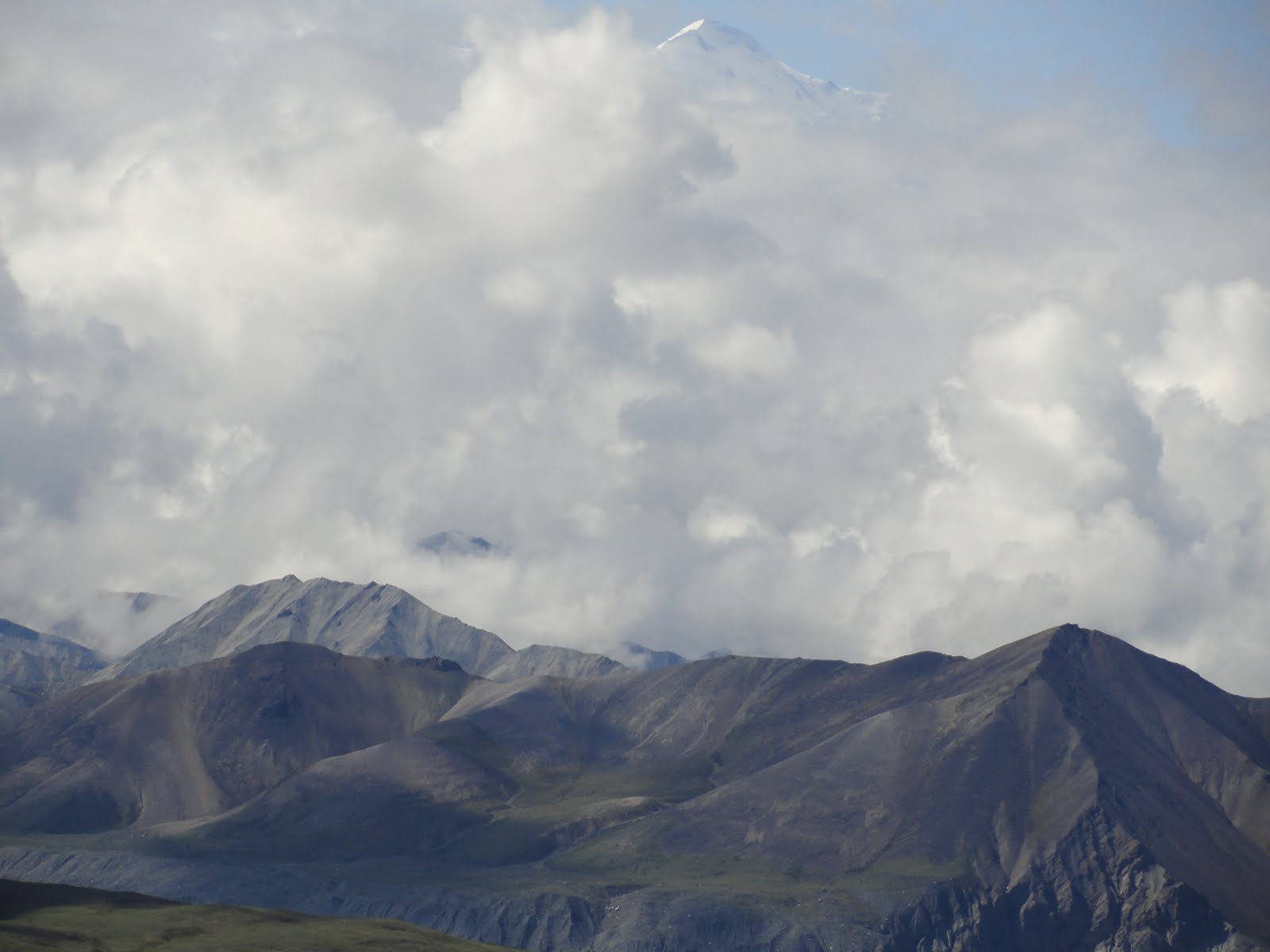
 We found out that it's very rare for park visitors to see all of Mt. McKinley, the highest mountain in North America--on any given day, there's only about a 25 to 30% chance of seeing the mountain. One ranger said that historically in July, it's visible (or "it's out," or "it reveals itself" in local lingo) only four days; in August, four to five days. Winter is the best time to see it. It's so big that it creates its own weather system. We were lucky; the sun was out, and we caught a few glimpses of parts of the mountain at different times.
Our first view of the peaks of Mt. McKinley from about 80 miles away--look above the clouds to see the peaks. It's a pretty awesome sight!


More views from various places along the Denali Park Road


A mother grizzly and two yearling cubs (look just at the edge of the cliff). Eagle Eyes Ernie could see them with his naked eye, but I could just barely make them out with the binoculars we had rented! The picture was taken with a 10X zoom . . . obviously we needed a much stronger zoom!

Farther along the road, another mother grizzly with two spring cubs (look between the creek and the bushes for the mother; the cubs are to her left at the lower edge of the grass)

More views from Denali Park Road


From the Eielson Center, the end of our ride, the base of Mt. McKinley showing through the clouds

The peak again (look above the clouds at the very top of the picture)

A little of the peak and a little of the base between the clouds


On the return trip, a mama grizzly and her two spring cubs (probably the same ones we spotted earlier)

An eagle in flight

A male caribou in the middle of the river bar

Some Dall sheep on the side of the mountain
 The entire trip was awe-inspiring and humbling--so much natural beauty and wildness--so different to see wild animals in their natural surroundings just being themselves instead of in captivity! It's just mind-boggling to see the variety and balance that was created, both in the terrain and wildlife!
 We originally intended to leave for Anchorage on Wednesday but decided to go back to Denali to the Visitor Center. We ended up spending hours there, reading and looking at all the exhibits, listening to a ranger presentation, and watching a movie. Then we had to spend a little (?) time in the bookstore and then eat lunch/dinner in their "grill." We decided before we left to make another trip to the Savage Creek Turnaround, as far as allowed. It rained all day Wednesday, but we decided we'd like to see it in the rain, too.
On the way we spotted a cow moose not far from the road

On the way back, we spotted another on the other side of the road

An idea of what the day was like!

This must have been the day and time for moose to eat dinner because we spotted another one very close to the road!


When we went by again, she had been joined by two bulls--our first close-up look at bull moose. One seemed to be younger . . . at least his antlers were smaller (but I guess I didn't upload any of the pictures of the younger bull)

The bigger bull posing for us between munching on the willows--in the pouring rain!


A very cloudy, misty, rainy day in Denali!

We finally headed south along the Parks Highway but decided to drive only as far as Cantwell
A scene of the clouds curling around the mountains along the way