Wednesday, August 18, 2010

Richardson Hwy. and Tok Cutoff Road to Nabesna Road

We drove from the park back up the Richardson Hwy. to the Tok Cutoff Road and this time could see some mountains and other scenery that had been completely shrouded by fog and clouds the last time we drove that stretch.
The Copper River, the source of some of the best red salmon!

The Wrangell Mountains from the Glennallen Airport
Mt. Drum--an awesome sight!
Mt. Sanford--impressive!
Mt. Sanford
Mt. Drum
Mt. Sanford
We were even blessed with another rainbow!
Rainbow over the Wrangell Mountains and Cobb Lake
The Wrangell Mountains and Cobb Lake
What a breathtaking dusk!
Mt. Sanford again


I just couldn't help but marvel at the beauty of creation surrounding us!

Wrangell-St. Elias National Park Visitor Center

When we left to complete the last leg of the Richardson Hwy., we intended to turn off the Richardson Hwy. onto the Tok Cutoff Road and head back to Tok. However, since we were so close, we decided to drive a little farther south and check out the visitor center at the Wrangell-St. Elias National Park and Preserve. Good move!! If any of you ever make a trip to Alaska, don't miss this national park, the largest in the nation! It's not as well promoted or advertised as Denali or others in the "lower 48," but well worth any time you can spend there. The visitor center is informative and attractive . . . we got there too close to closing to take full advantage of all they had to offer, but we saw an excellent video about the park showing footage of much of the park that's inaccessible, heard a talk by a park ranger, looked at some of the exhibits (not as much as we would have liked, but we were short on time), and took a short hike. The park has many hiking trails but we just chose a short, easy one. Still beautiful!
View from the back of the visitor center overlooking the Copper River valley with the Wrangell Mountains in the background
Trail through the boreal forest
A fish wheel, a traditional method of catching fish on the river
More views from the back of the visitor center

The hiking trail we took
s
Because of the excessive rain this year, the forest ranger said there are many more mushrooms than usual in the forest. They're huge! Ernie's foot to compare the size . . .


Last Leg of Richardson Highway

During our wanderings we had driven all the major Alaska highways except one eighty-one mile stretch of the Richardson Highway between Delta Junction and Paxson. Since we couldn't leave Alaska by the route we had planned, we decided to just stay a little longer and drive that last eighty-one miles. In order to get back to Tok, we'd have to drive over some previously driven highways, but the weather had improved, so this time we hoped to see some of the previously-clouded landscapes in the sunshine.

At a stop for gas, restroom, and refreshment, we discovered from a local Alaskan that behind a quarter mile row of trees along the road were acres of farm fields. Ernie had commented earlier that all of Alaska's food must be shipped in because he had not seen any farm fields, tractors, etc. Later we did find some agriculture around Palmer, but near Delta Junction we found more! Roads were gravel and pretty rough, but the old farm boy had no trouble navigating them and enjoying the farm scenery!
A hay field with bales of hay
South of Delta Junction we drove through some gorgeous mountain scenery! Glad we didn't miss this--it was worth the extra driving, even with some clouds moving in!

Alaska Pipeline again . . . we followed the Alaska Pipeline all the way from Deadhorse, near its origin, to Valdez (broken up at different times).
A panorama of some of the beautiful scenery
Delta River floodplain, where a herd of wild bison can often be seen grazing. We didn't see them though.
Glaciers on the distant mountains
We camped at Fielding Lake State Recreation Area beside a lake, above the tree line.
Fielding Lake, behind our campsite

From a wayside along the highway, we saw a road below that led close to a glacier. So Ernie the Adventurer decided he needed to check it out, while I kept saying, "Are you sure we should be here?" It didn't look like a road to me! Milepost described it as an abandoned pipeline road, the drive down into the valley was very steep, and the road was very rough! But off we went to explore . . .
Ernie walking along the path closer to the glacier after the road seemed to end
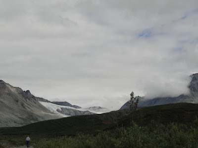
Fog around the top of the mountain and glacier
Panorama of the area
Close-up of the glacier
We could hear the sound of water but couldn't see it until we walked a little farther over a hill and found the glacier-fed stream.
After getting back on the highway, we passed Summit Lake.
Paxson Lake, where we camped previously after driving the Denali Highway from Cantwell to Paxson--with blue skies this time! When we camped there earlier, it rained all night and all morning. We had now completed the last leg of the Richardson Hwy., completing our drive of all the major Alaskan roads.

Pictures of Tok to Chicken and back

We drove from Tok, Alaska, up to Chicken on the Taylor Highway, thinking we'd leave Alaska via the Top of the World Highway, only to find out when we got there that the road between Chicken and the Highway had been washed out for the third time this summer. After a torrential rain the night before, it had been closed at 10:00 that morning--about the time we left Tok for Chicken. We spent a little time investigating Chicken (didn't take long), then drove back to Tok.
After days (seemed like weeks) of rain, we were glad to finally see some blue skies!
The results of a 2004 wildfire caused by lightening, which burned millions of acres of forest. One explanation we saw in a national park display said that forest fires are "nature's way of cleaning house."

A sign on the Taylor Highway, which I thought was a fantastic description of Alaska! It was referring specifically to the "Forty-Mile" region but could be said of much of Alaska.
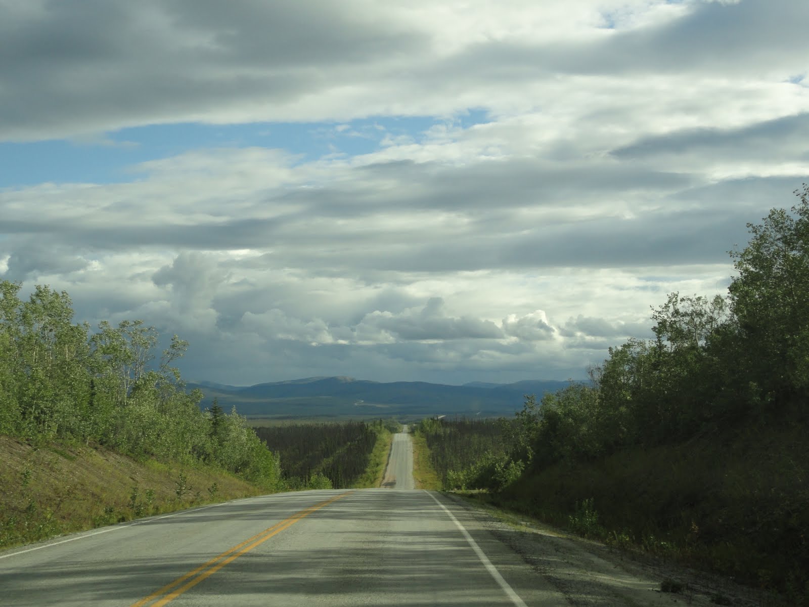
Even though we started out with blue skies, before we got to Chicken, the skies again clouded up, and we drove through rain off and on. We were disappointed in having more rain, but were rewarded with a fantastic rainbow light display shimmering across the landscape.

Looking more like a typical rainbow now

The post office in Chicken, AK
As we came over the hill, this is the sight that greeted us. This is the "newer" addition, not the old original town of Chicken. Their claim to fame there is gold mining--it's still an area with active gold mines and Chicken Creek (behind the buildings and in front of the road in the picture) still has gold flecks in it. You can try your hand at panning for gold, but we passed on that activity.
The Taylor Highway between Teslin Junction (near Tok) and Chicken--more clouds on the way back to Tok
. . . but we were rewarded with another rainbow!

Friday, August 13, 2010

Change of Plans--Chicken to Top of the World Highway

We found out late Wednesday night from the DOT website that the road north from Chicken that had been closed would reopen Friday morning--maybe.  A pilot car (truck) would take two convoys per day out of Chicken over to the junction with the Boundary Spur leading to the Top of the World Highway, the first leaving at 8:00 am Friday.  We left Tok Thursday morning planning to take the Alaska Highway out as planned, but as we got closer to the Taylor Hwy. leading to Chicken, we discussed the possibility of taking a chance that the convoy really would go through this time as planned.  At the last minute, we made a spur-of-the-moment decision and turned onto the Taylor Highway.  When we got to Chicken, they verified that DOT had made the decision to take a convoy north Friday morning.  So we hung out in Chicken the rest of the day, spending our time panning for gold in Chicken Creek (we didn't find anything), and spent the night there.  The area around Chicken, called Forty Mile, is still an active gold mining area, and people often find little flecks of gold in the creek.  We weren't very patient and didn't really know how to pan properly, so we gave up easily.  But at least we tried it!


Friday morning we lined up in the convoy, which left a few minutes before 8:00.  It was slow-going and very dusty with so many vehicles traveling together on a dirt and gravel road, but the scenery was worth it!  The pilot truck dropped us at the Boundary Spur Road; a short time later we went through customs at the Canadian border very smoothly, and proceeded onto the Top of the World Highway, which is very aptly named!  Again, gorgeous scenery and perfect weather!  The Top of the World Highway ended at Dawson City, Yukon Territory, which we spent a little time investigating.  It's an old gold mining town and still retains the flavor of the old town, with quaint little shops in old-timey buildings and wooden streets.  A fun place to spend an afternoon!


We thought about driving a little further but weren't sure about accommodations within a reasonable distance, so we decided to spend the night in Dawson City.  Tomorrow we'll try to make it to Whitehorse, which will be a pretty long day (more than our usual 200-250 miles). 


Again, the internet here has bandwidth limitations, so I can't upload pictures again.  Maybe in Whitehorse . . .